Rivers of Kaokoland and Damaraland
Rivers of Kaokoland and Damaraland
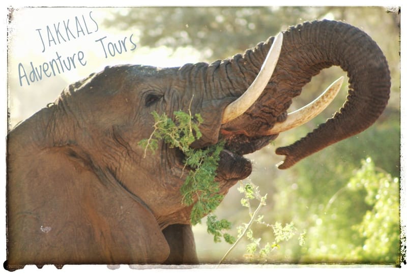
Get ready for an epic off-road adventure in one of Africa's last true wildernesses! This guided tour with Jakkals takes you deep into the stunning Kunene Region (Kaokoland), following ancient riverbeds, tackling legendary passes, meeting fascinating cultures, and spotting unique wildlife like desert-adapted elephants. Expect breathtaking scenery, starry nights, and that unbeatable sense of exploration. Total distance around 1,500 km of gravel, sand, and rock – perfect for experienced 4x4 enthusiasts.
Arrival Day: Raycana Camp (32 km from Ruacana)
Arrive anytime at beautiful Raycana Camp on the Kunene River, aim early to soak up the paradise vibes with river views. Fuel up in Ruacana, then head west on C46 past the impressive Ruacana Falls. You will meet Jakkals there round 17:00, we will install radios and discuss the days ahead over dinner.
Overnight: Camping at Raycana Camp.
Day 1: Kunene River to Epupa Falls (130 km)
Follow the mighty Kunene River, stopping at historic Swartbooisdrif. The place gets its name from Petrus Swartbooi, a captain of the Swartbooi Nama clan who raided the area in the 1890s. Legend has it he died there after a crocodile attack, talk about a wild way to leave a legacy!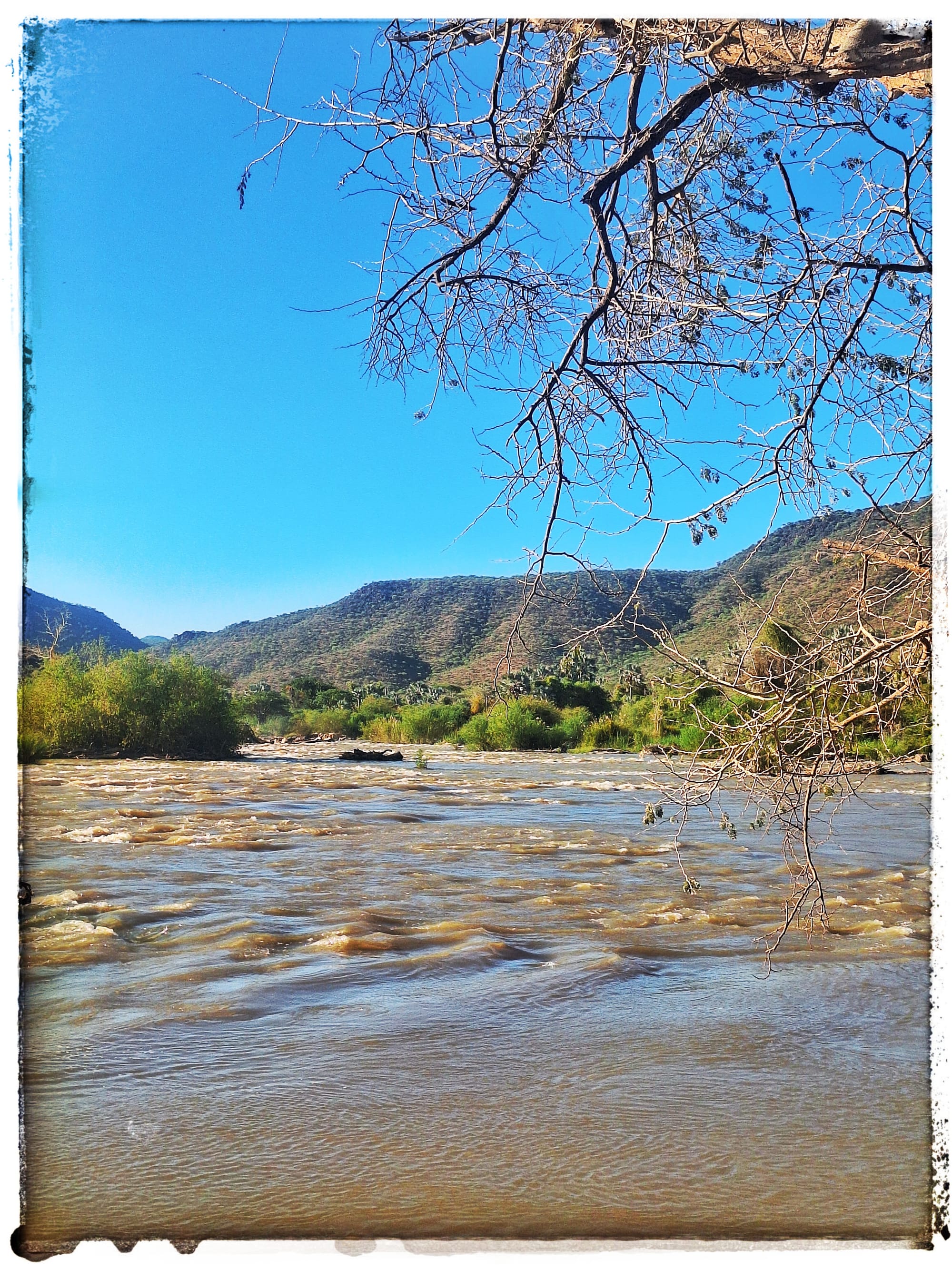
It's famous as the spot where the Dorsland Trekkers crossed the Kunene River. In 1881, these hardy Boer families from South Africa headed into Angola seeking better land, braving thirst, malaria, and tough terrain. Many returned decades later (around 1928–1929), crossing back at the same ford.
Then on to the spectacular Epupa Falls, a series of cascades plunging into a gorge, surrounded by baobabs and palms. "Epupa" means "falling water" in Himba and it lives up to the name. We should arrive round lunch. Relax the afternoon around the swimming pool.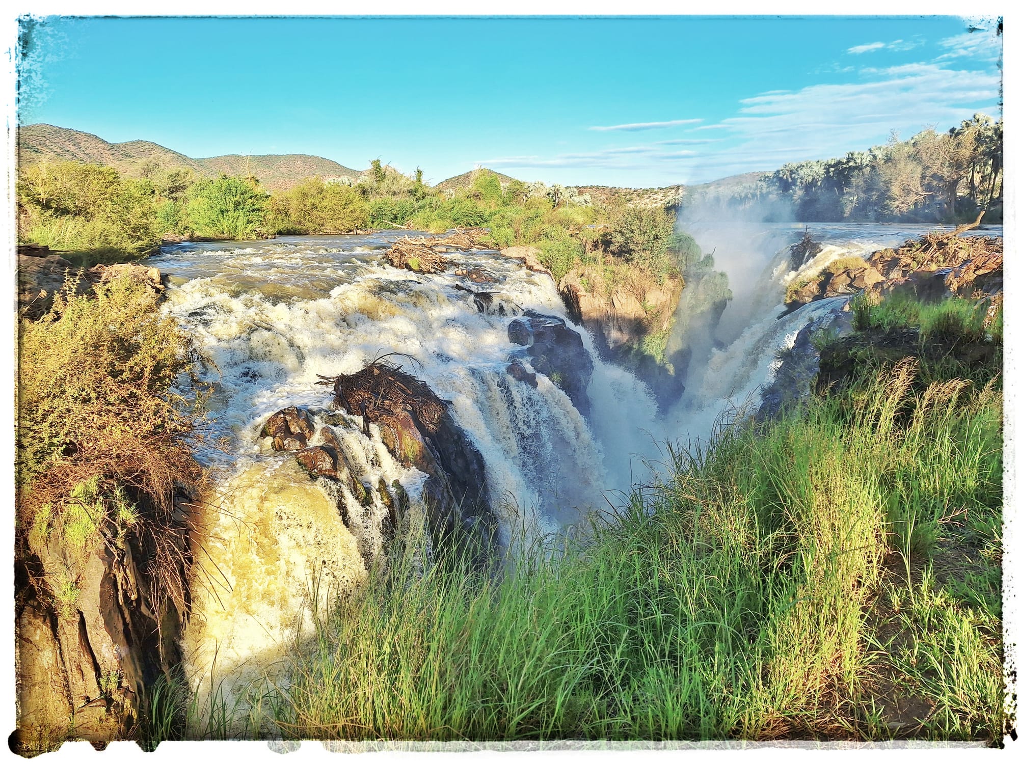 Epupa Falls
Overnight: Camping at Epupa Falls.
Day 2: To Opuwo with Himba Encounters (180 km)
Head south, seeing the incredible Himba people, semi-nomadic herders famous for their red ochre skin, elaborate hairstyles, and traditional lifestyles. Expect warm, authentic interactions and insights into their culture.
Arrive in Opuwo for fuel, a quick shopping session and then "head out" of town.
Opuwo got its name from a charming (and slightly cheeky) story dating back to the 1920s.
During the colonial era, Carl Hugo Linsingen Hahn (grandson of the famous missionary Carl Hugo Hahn and known as "Cocky" Hahn) served as the commissioner from Ondangwa. He arrived in the area looking for land to build an administrative office.
He asked the local headman for a plot, and the headman generously offered a small piece. When the headman tried to give him even more land, Hahn replied in Otjiherero, "Ohopoho!" – meaning "it's enough" or "that's plenty for me, I don't want any more!"
The place became known as Ohopoho, and in 1974, due to orthographic reforms in the Herero language, the spelling was updated to the modern Opuwo, which still carries the meaning "enough" or "finished/the end".
Overnight: Wild Camping near the upper Hoarusib River.
Day 3: Toward Van Zyl's Pass (180 km)
We head toward the remote Otjitanda Village, a traditional Himba settlement in the heart of Kaokoland, before crossing the scenic Hoarusib River for the first time. This lush, ephemeral waterway brings unexpected life to the desert. We briefly follow its sandy bed before veering away, winding through rugged tracks toward our evening stop at Van Zyl's Community Camp, perfectly positioned for an early morning tackle of the legendary pass. As we venture deeper into Namibia's wild Kunene Region, the landscape opens into a timeless savanna scattered with ancient mopane and leadwood trees, some of these tough, gnarled beauties are centuries old, surviving droughts and floods like true desert warriors. We spot more resilient Himba people with their cattle, masterfully thrive in this harsh environment, moving with the seasons in perfect harmony with the land. It's a beautiful reminder of enduring traditions. 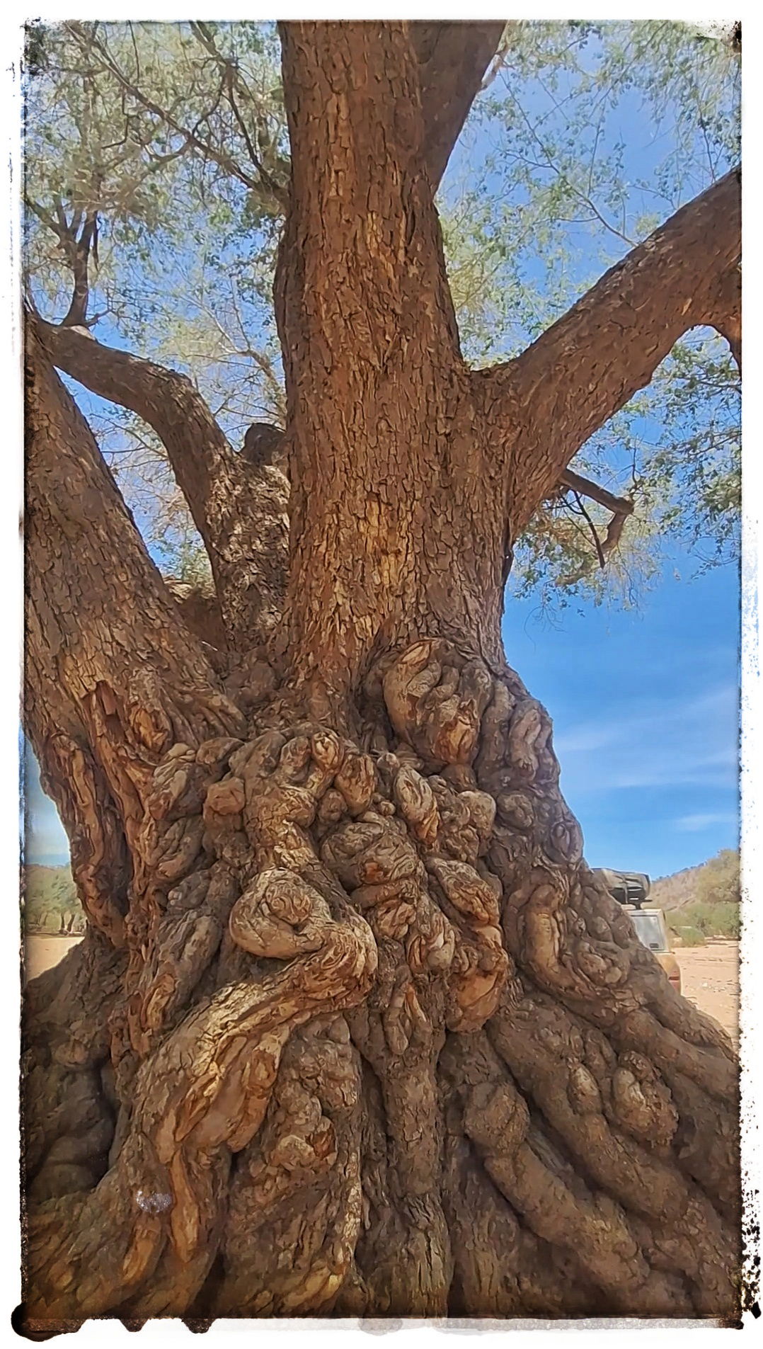
Overnight: Wild camping at Van Zyl's Community Camp.
Day 4: Van Zyl's Pass & Marienfluss (100 km)
Conquering Van Zyl's Pass
Part of the adventure is Van Zyl's Pass itself a thrilling 16 km stretch that's widely regarded as Namibia's toughest 4x4 route. This beautiful, snaking trail winds through the dramatic Otjihipa Mountains, originally following ancient game and cattle trails used by local herders.
Back in 1965, the legendary Ben van Zyl (affectionately called "Oom Ben"), then Commissioner of Kaokoland, oversaw its construction. With just 20 local labourers, an old Ford pickup, a tractor, and basic hand tools like spades, crowbars, and picks, they carved this epic path through boulders, ravines, and steep drops in about four months all by hand!
Don't worry, we tackle it slowly and safely with Jakkals' expert guidance. As you descend, the vast golden expanse of the Marienfluss Valley opens below like a dream, making every rocky bump worth it. 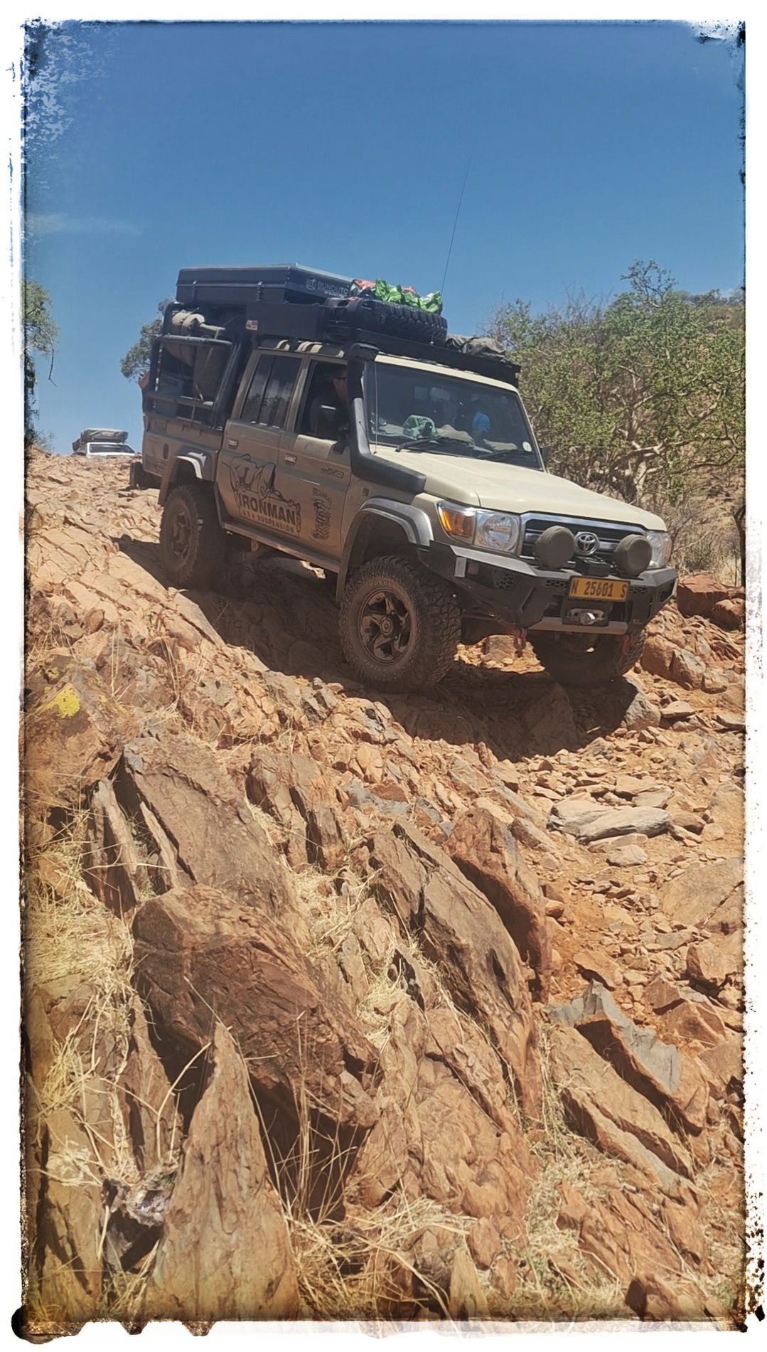
Pure adrenaline and awe, one of the highlights of any Kaokoland trip!
Into the Magical Marienfluss Valley
After conquering Van Zyl's Pass, we descend into the breathtaking Marienfluss Valley (also known as Marienflüss) – one of Namibia's most remote and stunning wilderness areas in the Kunene Region. This vast, open valley stretches toward the Kunene River and the Angolan border, flanked by the dramatic Otjihipa Mountains to the east and the rugged Hartmann Mountains to the west. It's famous for its golden grasslands and scattered fairy circles. 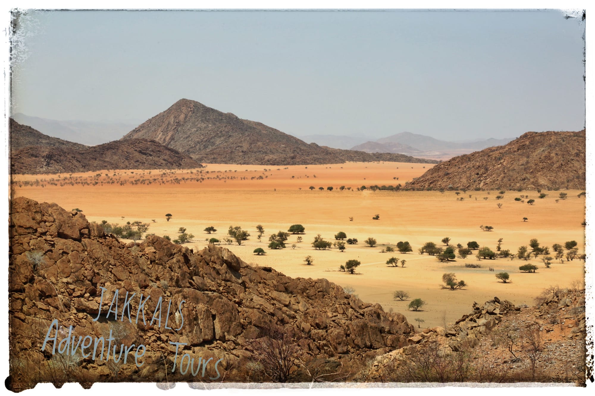
Overnight: Wild camping tonight in a river bead that very few know of.
Day 5: To the Khumib River (200 km)
Bidding farewell to the vast grasslands of the Marienfluss Valley, you’ll pass the iconic Red Drum, a historic landmark left by “Oom Ben” van Zyl as a petrol cache and navigation point before tackling the challenging Joubert Pass (also known as Rooidrom Pass), a rugged 4x4 track with breathtaking views.
Next, explore the remnants of an old marble mine, an abandoned site that adds a touch of intrigue to this remote landscape. From there, head to Orupembe and its famous “Shop No. 1” - renowned for serving the coldest beer in Kaokoland! Continuing south, greet some of the enigmatic “lonely men” (mysterious stone sculptures scattered across the region) and pass Ogams Fountain before descending into the dramatic Khumib River valley.
The landscapes here are simply stunning, vast expanses of desert that appear as if painted by an artist’s brush, with shifting colours and surreal rock formations. You’ll encounter more of the “lonely men” en route as you make your way toward the Hoarusib River, where you’ll set up camp for the night. 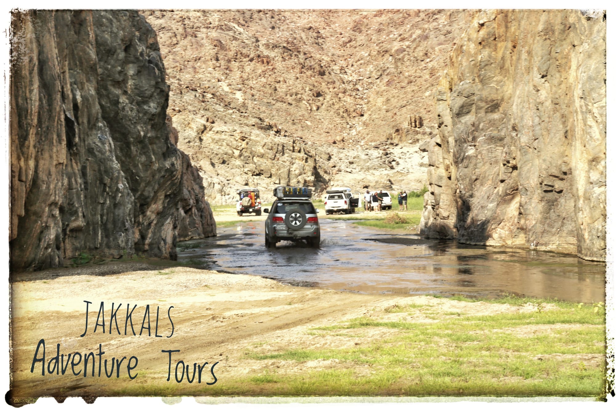
Overnight: Wild camping in pure wilderness along the Hoarusib River
Day 6: Hoarusib & Hoanib Rivers (180 km)
Continuing along the Hoarusib River from your wild camp, this ephemeral river cuts a dramatic path through clay canyons and floodplains toward the Skeleton Coast. Lined with ana trees and Makalani palms, it forms a vital green ribbon sustaining extraordinary wildlife in one of the driest places on earth. The Hoarusib is renowned for its population of desert elephants, who expertly dig for underground water and navigate vast distances in search of food.
The Hoanib River: Wildlife Haven.
Transitioning to the neighbouring Hoanib River, often considered one of Africa's most beautiful desert rivers, you'll follow its wide floodplain eastward. This larger oasis supports even richer biodiversity, including healthy populations of desert-adapted elephants, giraffe, gemsbok (oryx), and one of the world's only desert-dwelling lion prides. The contrasting scenery, vast dunes meeting lush vegetation creates unforgettable photo opportunities.
Sesfontein: Historic Oasis
The journey culminates as you emerge from the wilderness into Sesfontein, a verdant palm-fringed settlement fed by natural springs. This unexpected oasis in the arid northwest is home to the iconic Fort Sesfontein, a restored German colonial fort built in 1896 to protect against poaching and smuggling
Overnight: Wild camping in the area.
Day 7: Khowarib Gorge to Beesvlakte (140 km)
Narrow gorges, towering rocks, more elephant spotting, dusty tracks, and massive ancient ana trees, driving through the dramatic Khowarib Schlucht in the upper Hoanib River valley and onward to the expansive, dusty plains of Beesvlakte.
Expect challenging 4x4 tracks, thick, soft sand and stunning geological formations, and excellent opportunities to spot desert-adapted elephants amid ancient Ana trees. 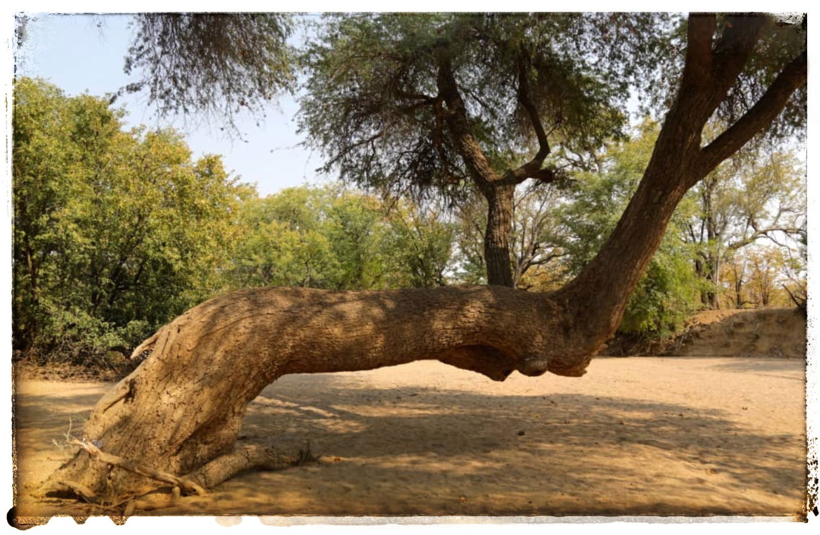 Ancient Ana Trees
We show you another large river feeding the upper Hoanib river, top frequently for photos of the massive ancient Ana trees lining the riverbeds, which provide vital shade and food for elephants.
Arrive at your wild camping spot in the open plains of Beesvlakte.
Day 8: Huab River (180 km)
This day shifts from the vast plains into the rugged Huab River valley, a lesser-known gem in Damaraland known for its deep sandy tracks and exceptional wildlife sightings in one of Namibia's harshest desert environments.
Break camp early and head southeast toward Kamanjab for essential refuelling.
We continue to Xorixas where just after we will turn away for the Huab River. We wil encounter section with thick sand, rocky sections, and potential water crossings (depending on rare rains). Drive slowly through the dry riverbed, scanning for desert elephants digging for underground water and graceful giraffes browsing on acacia trees magical sightings in this arid oasis.
Wild Camping in the riverbed, dinner under the emerging stars, and listen for wildlife calls in the quiet night. 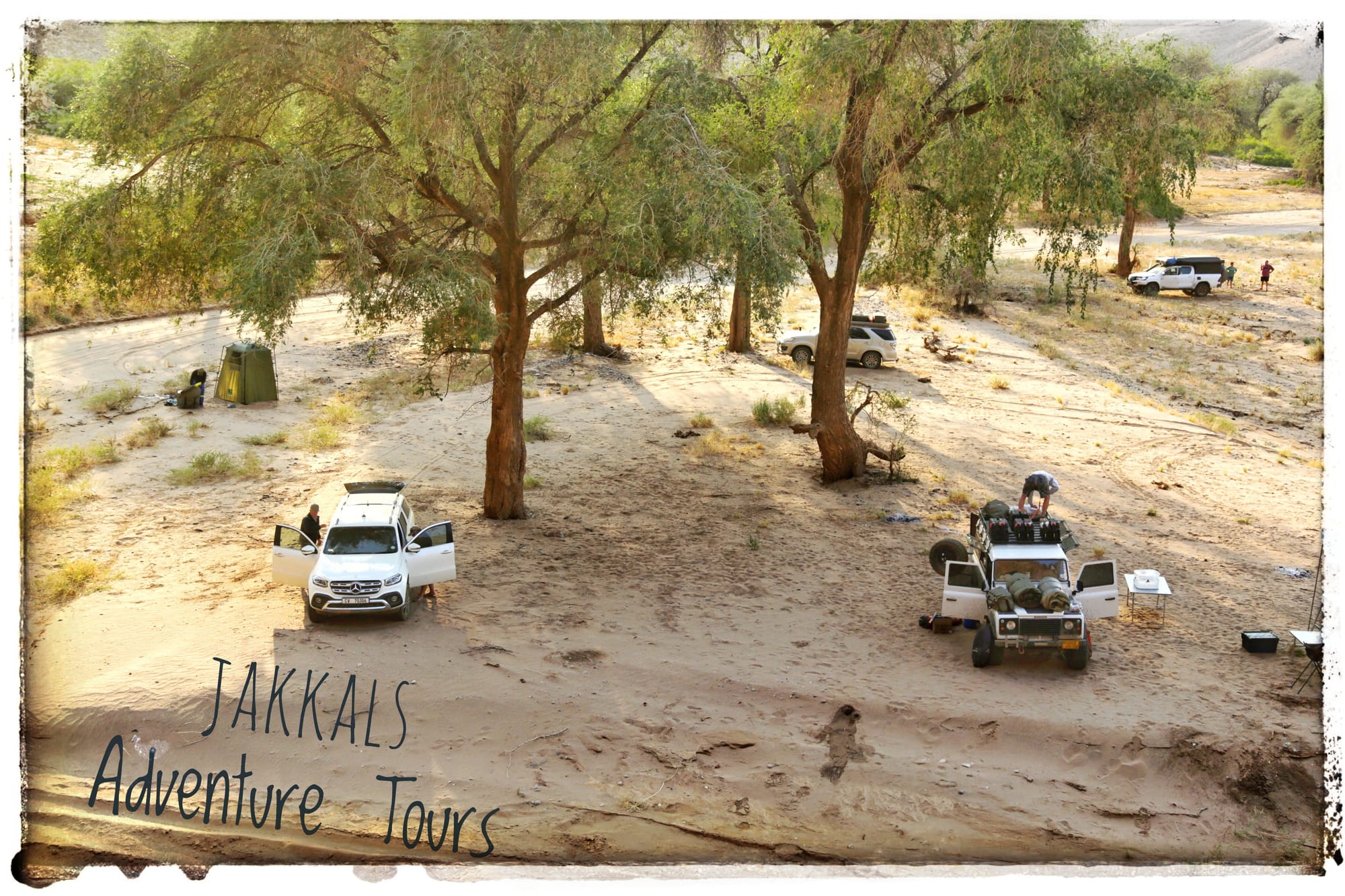
Day 9: Aba Huab and Ugab River (180 km)
Continue along the riverbed and hop over into the Aba Huab River. We pass by the Twyfelfontein (UNESCO World Heritage Site), an ancient San rock engravings dating back 6,000+ years, depicting animals, rituals, and daily life.
If time allow and it’s not to hot we might stop over for a small, guided walk to have a look at the engravings.
Nearby, explore the columnar basalt Organ Pipes formations and the strikingly coloured Burnt Mountain. 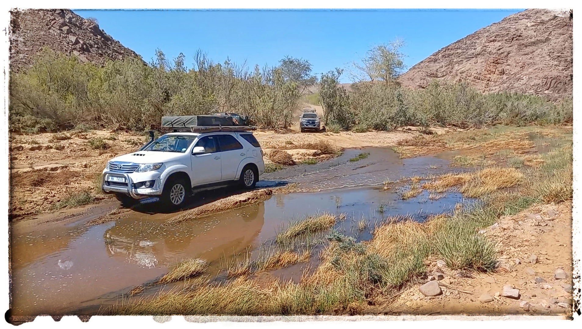
Simple Explanation what happened at the Burnt Mountain:
About 130 million years ago, hot molten rock (magma called dolerite) pushed up from deep underground into layers of older dark shale (mudstone rich in organic material).
The intense heat "baked" the shale like an oven, turning it into dark, slag-like rock (like burnt coal waste).
Over millions of years, erosion wore away the surrounding rock, exposing this blackened hill.
The Organ Pipes: tall columnar basalt rocks formed when the same magma cooled and cracked into hexagonal shapes.
We see lots of Welwitschia plant as we work our way over “Land Cruiser Hill” to visit our final river for the trip, the Ugab.
We end the tour of with a final group dinner at the campsite.
Tonight’s camping is also included in your tour. If you want to upgrade, it will be 100% for your own account.
End of Tour.
Tour Price: 2027.
- Adults: N$15,900.00
- Child Age to 5: No Charge.
- Child Aged 6 to 15: N$6900.00
Dates available for this tour 2027:
- 20 to 28 May
Tour Inclusions & Exclusions
What's Included in Your Adventure
- First night camping at Raycana
- Daily Meals: Breakfast and dinner provided each day (2 meals per day)
- Expert Guidance: Professional guides with their own dedicated vehicles
- Safety & Communication: Two-way radios equipped in all vehicles for seamless coordination
- All Essential Fees: fees, and communal charges covered
- Camping and dinner on the last evening at Brandberg White Lady
What's Not Included
- Beverages (including bottled water) during meals
- Any upgrades to accommodation or modifications to the planned itinerary
- Camping equipment (we recommend bringing your own or arranging rental in advance)
Important Information
- Pricing Note: Tour costs are calculated based on current government taxes and regulations. In the event of changes, we reserve the right to adjust prices accordingly.
- Insurance Requirement: All participants must have comprehensive travel and medical insurance that covers adventure activities in Namibia.
Ready to explore Namibia's stunning landscapes? Book Your Tour Now.
Download your booking form here: Booking Form - NEW.xlsx
What Clients Need to Bring
To ensure a comfortable and safe self-sufficient 4x4 adventure, please prepare the following items. We operate in remote areas, so being fully equipped is essential.
Personal Camping Gear
- Your own camping equipment: tent, sleeping bag (bedroll), ground sheet, chairs, and any other items for comfort.
- Personal cutlery, crockery, and cooking utensils.
- Personal items: medication, sunscreen, flashlight/headlamp, camera, batteries, and toiletries.
Food & Beverages
- All beverages, snacks, and lunches for the duration of the tour.
- Drinking water for personal use.
- Minimum 60L of water for showering/washing.
- 20L of clean, potable water dedicated to cooking for the kitchen.
Firewood & Waste
- Two large bags of firewood per vehicle (more may be required depending on the tour – we will advise in advance).
- Strong, heavy-duty garbage bags (garden-grade recommended). Clients are responsible for carrying out all their own waste.
Vehicle & Water Recommendations
- If your vehicle has an onboard water tank, we recommend bringing an additional 20L jerry can for easier refills from local sources.
Your 4x4 Vehicle
- Ensure your vehicle is mechanically sound and fully serviced before departure.
- Carry a tyre pump and pressure gauge.
- At least one spare tyre.
- Recovery points/hooks fitted front and rear.
- You need to carry enough fuel for at least a 1000km range.
Insurance Note: Please confirm with your insurance provider that your vehicle is covered for off-road travel in Namibia (or the relevant country). In the event of a breakdown, we will assist with on-site recovery at an additional cost.
Important: Insurance & Emergency Cover
- Travel insurance and medical evacuation coverage are compulsory. Clients must arrange their own comprehensive policies.
Emergency Contact
- Satellite Phone (for emergencies only): +881 6 315 73962. This number allows family members to reach you when out of cellular range. It is not for general use.
- If you need constant connectivity, please bring your own satellite phone.
We look forward to an unforgettable adventure – pack well and travel safely! 🚙🏜️
See you soon
Jakkals