Faces of the Namib
Faces of the Namib dune crossing.
In 1948, Willem Christoffel van Coller had bought some land (about 30,000 hectares) for Karakul sheep farming and moved in with his family. His wife, Elsie Sophia van Coller, named the farm, SOLITAIRE, probably because of its unique solitary location.
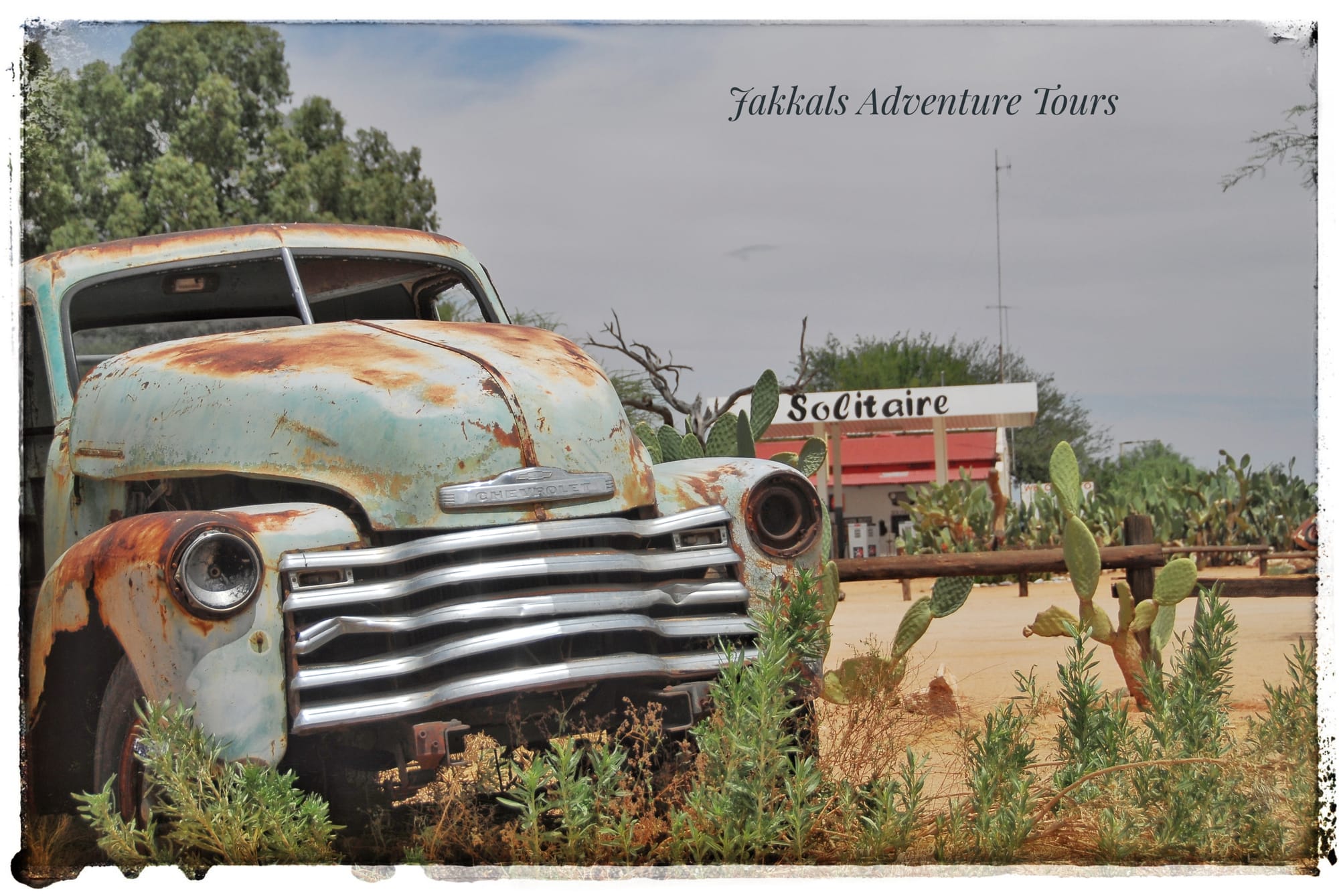
Solitaire is the assembly place, where we will meet each other for the first evening and you will be welcomed, with a true Namibian welcome braai. We will discuss the planning/program for the days ahead. Two way radios will be installed to make sure that you are well prepared for your tour adventure. Please be at Solitaire not later than 16H00 on this day. Arrangements as to the meeting point will be given prior to your tour.
 Day 01:
We depart from Solitaire after breakfast. We continue on the gravel road north towards Walvis Bay for 30km, where we will turn of to the left entering the Namib Naukloof National Park gate. The park was established in 1907 when the German Colonial Administration proclaimed three game reserves in "German South West Africa". Today's Namib-Naukluft park was proclaimed as "Game Reserve No. 3".
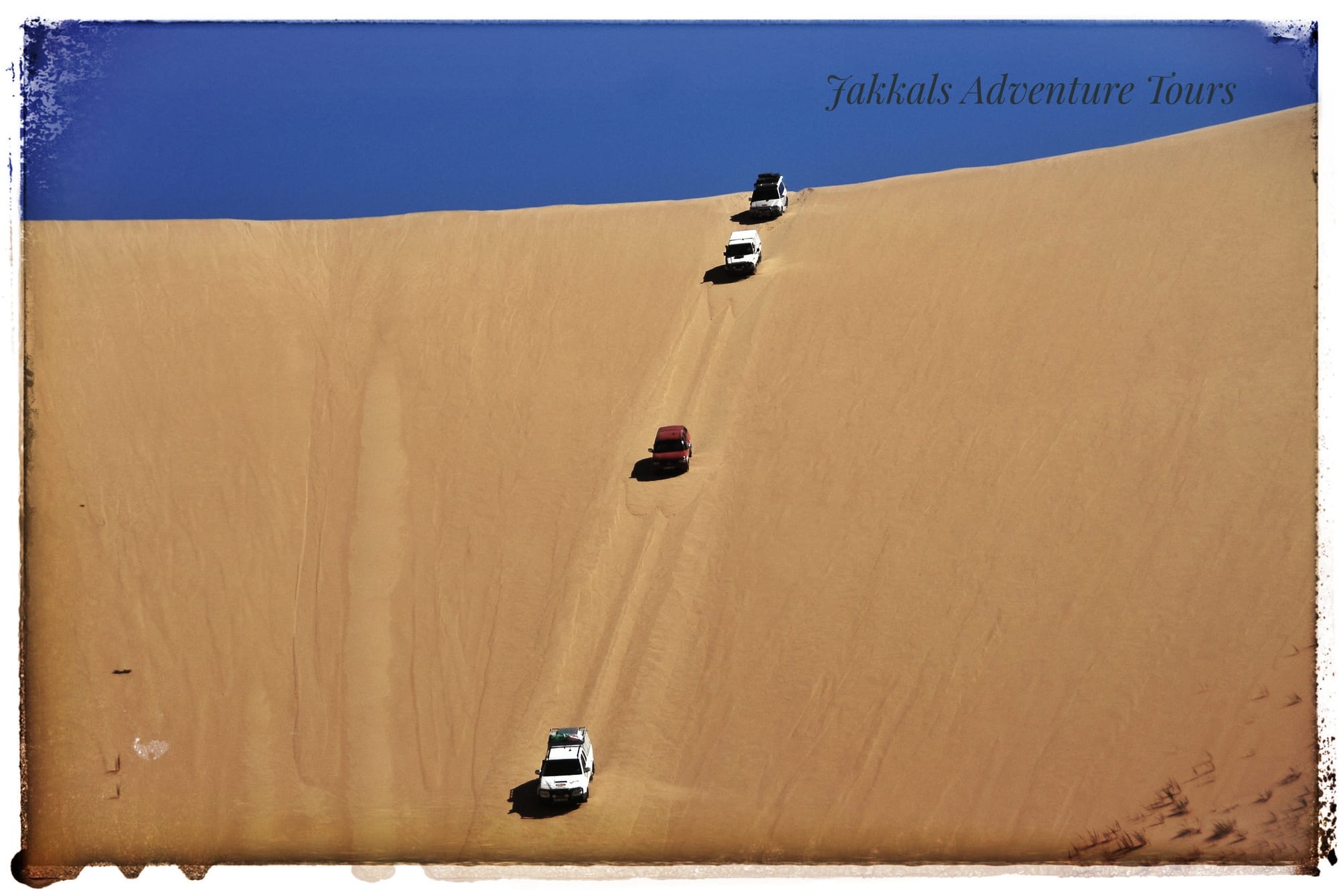
The trail we are about to follow was used in the 1800's by the early settlers and German Schutztruppe driving their Ox-wagons through the valley with the "Saagberg" on the left and the "Kamberge" on the right to the dunes making way to Walvis Bay. The two-spore track will take us through very sensitive areas and staying in the road is essential. What makes it even tougher is that the sand is soft and we have to be "on top of our game" navigating through the area. We should be at the "Kloofie" more or less by lunch time. From there we make way for the Kuiseb River dropping, down a huge slipface, not your average entrance but something you will never forget.
We will camp in the Kuiseb river that evening.
 Old Ox-wagon trail.Day 02:
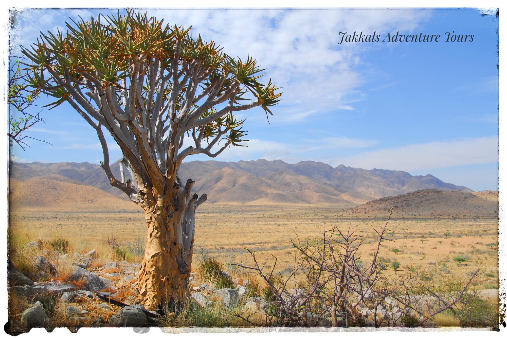
We leave the Kuiseb river and travel South West making way for the Tjondap Valley. We are still in the pro-Namib, the transition zone between the arid Namib and the more mesic escarpments to the East. The next few days we will be experiencing the different dunes, found in the Namib, as we work our way to the coast.
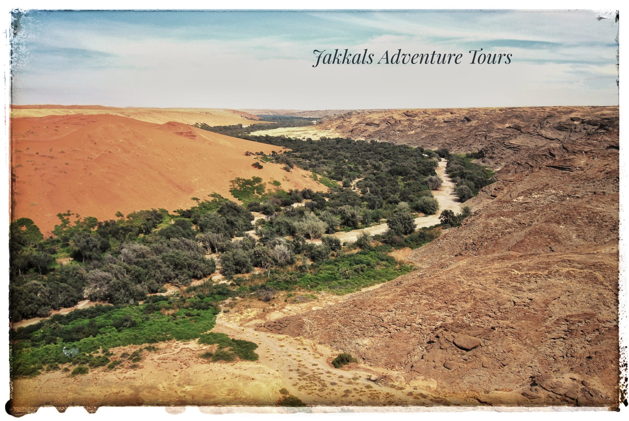 Where the Kuiseb river stops the dunes.
We are in the heart of Star dunes now, recognized by their three or more arms, formed from multiple wind directions. Where star dunes are present, an areas wind regime is complex. Star dunes form only in places where wind blows from varied directions over the course of a year. These dunes are very stable and don't move much with a slip-face on both sides of the dune.
The area is filled with Namib Dune Gras, (Stipagrostis obtusa), dune bushman grass, growing on little sand hills and covering the valley floors. We will camp in the dune valleys the evening among these spectacular dunes.
 Star Dunes.Day 03:
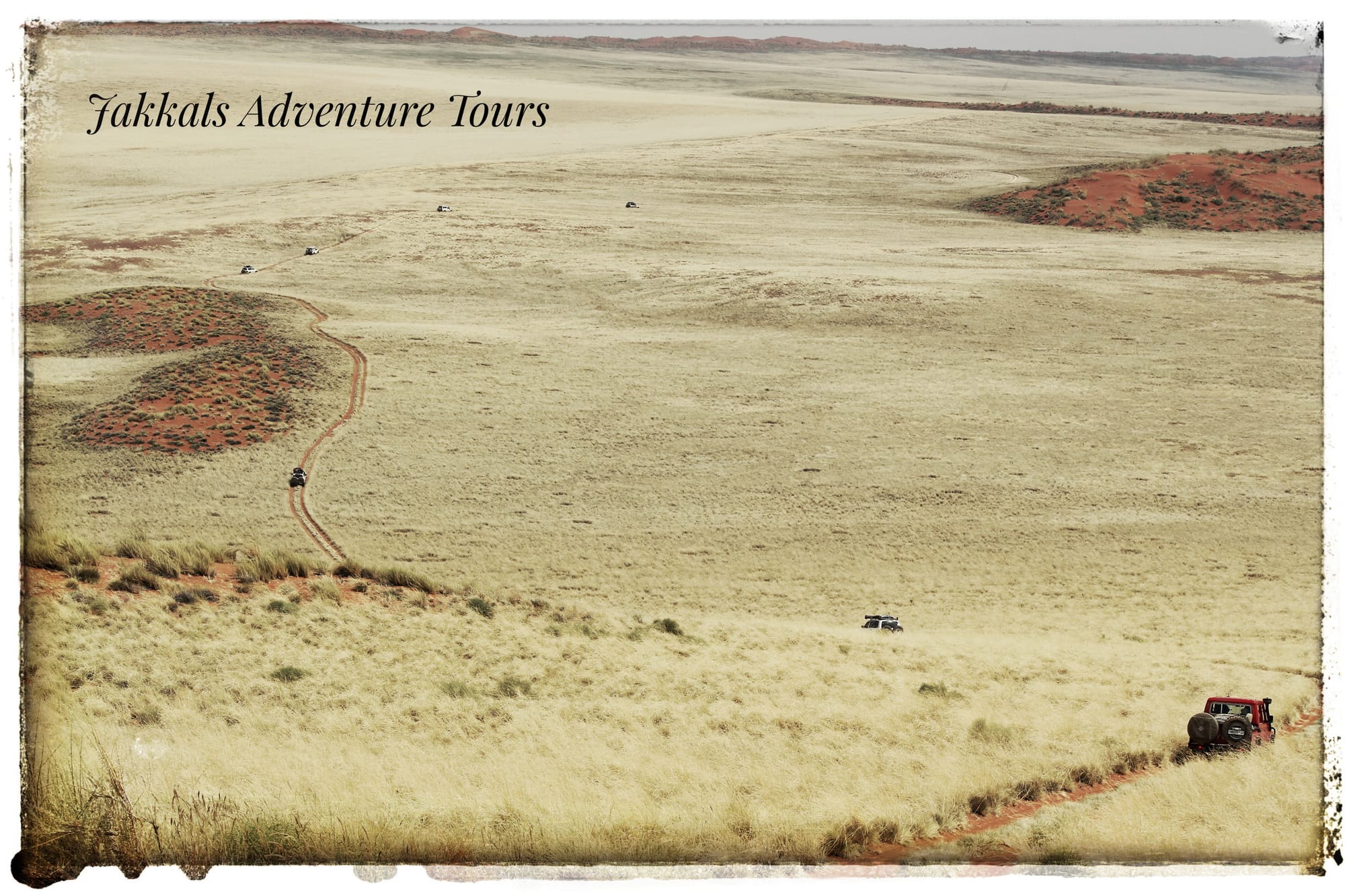
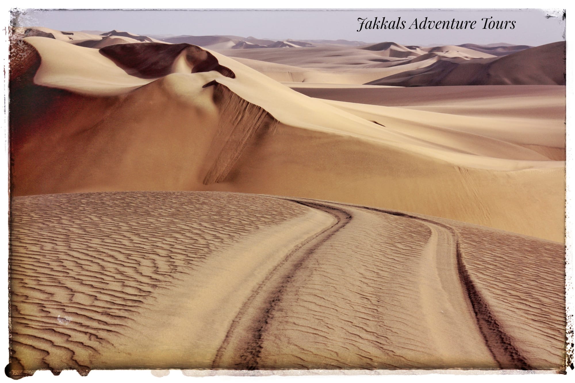
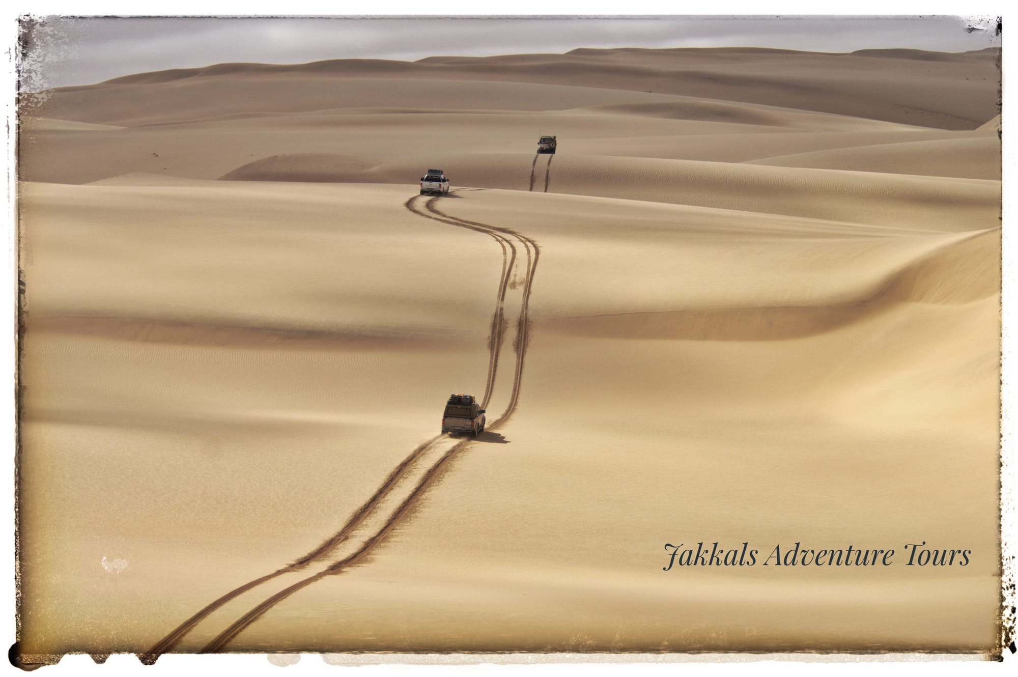
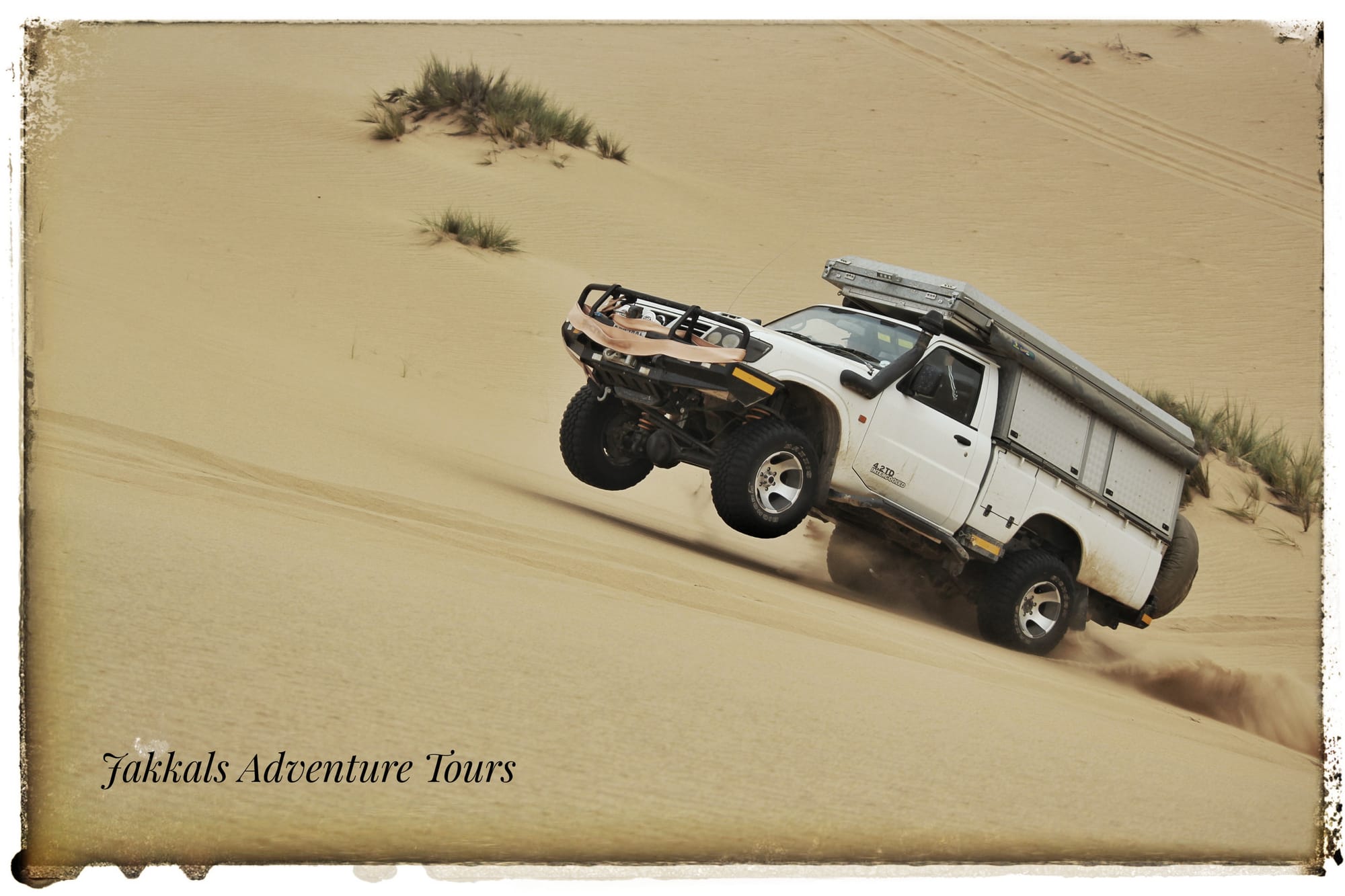
Right from the start we enter another dune belt, dunes that are known to be massive, and our engines will roar today.
Transverse or Linear dunes form straight or nearly straight lines. Some linear dunes are shaped like a wiggling snake, with regular curves. Linear dunes develop where wind pressures are nearly equal on both sides of a dune. These dunes are considered as some of the largest dunes in the world. We will try to get to the top of the highest dune in the area today, see if it would be possible.
 How does one know that the Namib is the oldest desert on earth? The answer is revealed by the fossilized dunes of the Namib, or rather, dunes turned into stone that formed under the new sand on top of them. Largely covered by the sand sea of the ‘young’ Namib, the ancient sandstone layers (petrified dunes), become visible when wind patterns start to open them up.
These former dunes were already there about 20 million years ago. The sand compacted into sandstone during more humid phases millions of years ago. But desert conditions prevailed in many parts of today’s Namib even during ‘humid’ periods. That is the reason why experts regard the Namib as the oldest desert on earth.
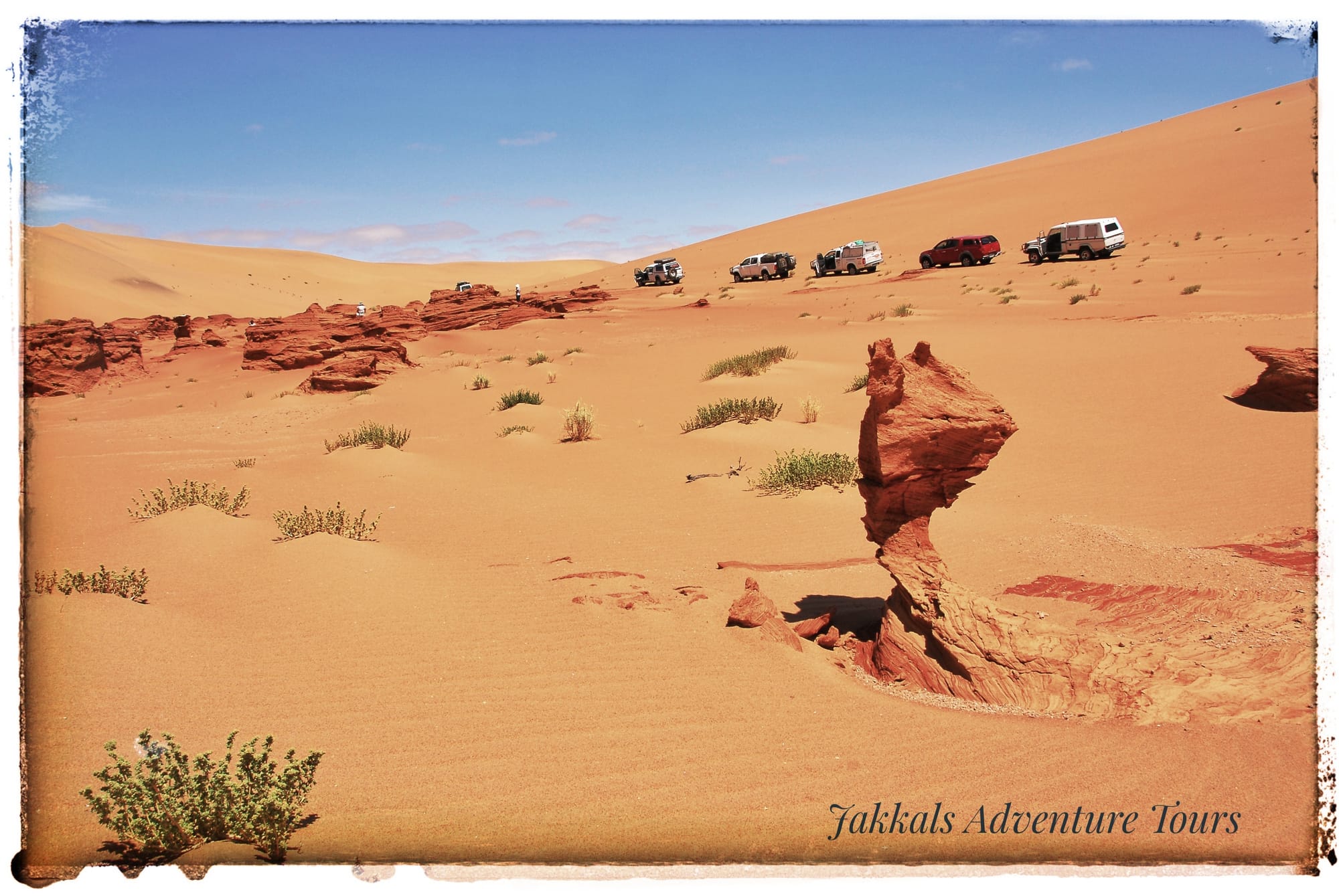 Petrified dunes.
After lunch we make way for "Olifantsbad", a basic camp we have in the dunes, where we will spend the next two evenings.
Wild camping at "Olifantsbad".
Day 04:
Today is a day full of fun, we will test our driving skills and even take on a few roller coasters in the dunes.
 Play time.
Namibia's exploration by Europeans commenced from this coastline as early as 1485, although the inhospitable Namib desert barred access to the interior. The probably first European to set foot on Namibian soil was the Portuguese Diogo Cao or Diogo Cam, followed by Bartholomeu Diaz two years later, on 8 December 1487. This date represented the holiday of "Maria's Conception". Therefore the bay received the name" Santa Maria da Conceicao" (Conception Bay). Since the 16th century the Portuguese called Conception Bay "Bahia das Bahleas" (Walvis Bay), due to the rich occurrence of whales.
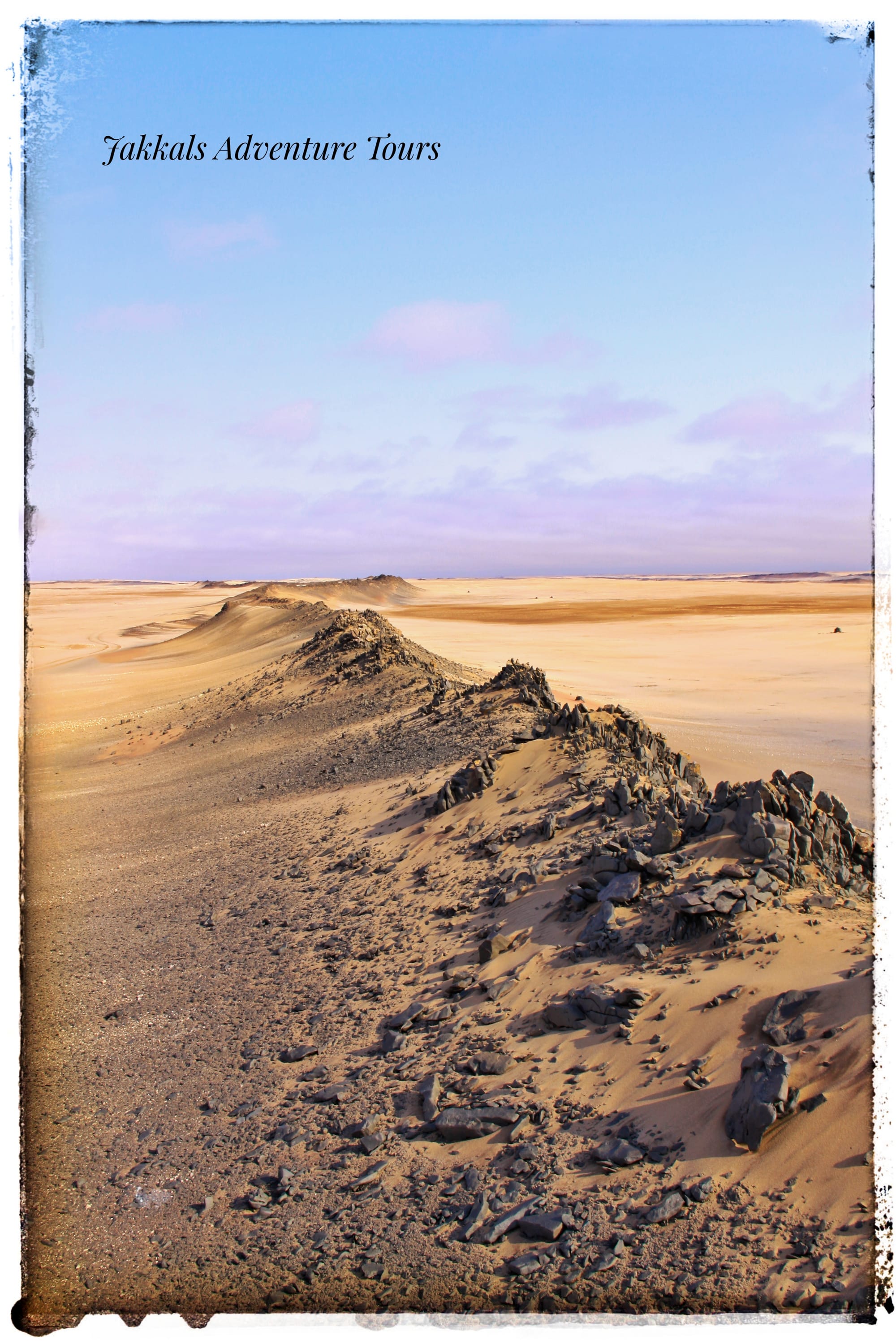 Dolerite ridges.
The railway worker August Stauch from Thüringen, who came to the German colony in 1907 was instructed to keep a 20 km long stretch of railway free of the ever shifting sand. One of his workers, Zacharias Lewala found a strange looking stone which he handed to Stauch. This was the start of a very rich diamond mining area in the Namib. We pay visit to one of the old diamond mining towns.
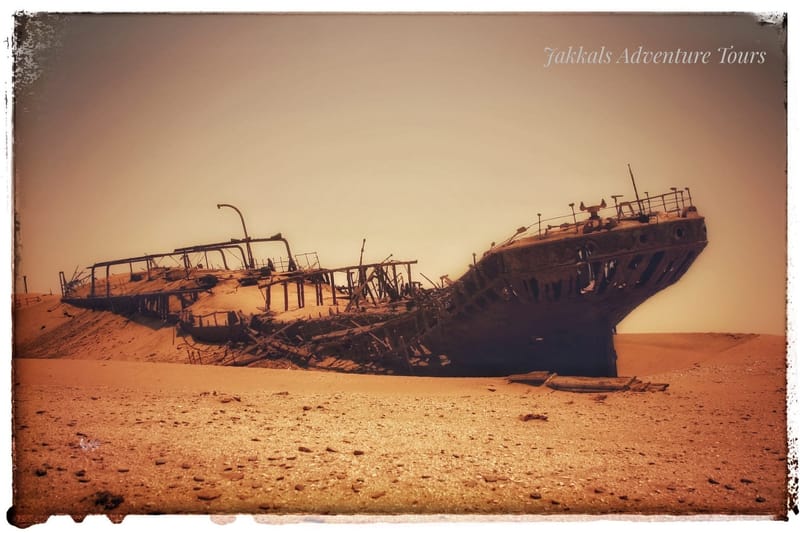
Trapped within very thick fog, the Eduard Bohlen ran aground just north of Conception Bay on 5 September 1909. The cargo ship now lies partially buried beneath the sand, destined never to complete its journey from Swakopmund to Table Bay again.
We head back to "Olifantsbad" for our last evening in the Namib.
 Slip Faces over 102m long.Day 05:
We pass the wreck of the Shawnee, a tugboat stranded in 1979. From there we pass through the "Lange wand", a patch of beach where the ocean meets the sand dunes and can only be navigated when the tide is absolutely right.
Diogo Cão named the area Port d’Ilheo (point of the island) in 1486 when he entered the natural harbor. The importance of the harbor at that time remains a mystery, but later in the 19th century it became a commercial fishing and trading port. It was especially attractive to sailors for its fresh water, and supported various industries such as whaling, fish processing, beef canning and guano collecting. In 1884, it gained more importance as a supply harbor for the German-occupied South-West Africa. However, it was soon replaced by the harbor in Swakopmund. It is a marine sanctuary and RAMSAR site supporting more than 50,000 birds in the summer and 20,000 in the winter.
We will be in Walvis Bay round lunch or just after.
Swakopmund is recommended for you to stay after the tour.
 Map of the route.Tour Price SADC Members: 2026.
- Adults: N$15,530.00
- Child Age to 5: N$2000.00
- Child Aged 6 to 12: N$6000.00
- Child Aged 13 to 16: N$7500.00
Tour Price NON-SADC Members: 2026.
- Adults: N$16,000.00
- Child Age to 5: N$2200.00
- Child Aged 6 to 12: N$6400.00
- Child Aged 13 to 16: N$7800.00
Tour Dates: 2026.
- 13 to 17 July - Fully booked.
- 26 to 30 October - Fully Book (Land Cruiser Club SA).
- If you have a group, put together we can create a date for you.
If you want to put a group together, you are welcome to contact us for more dates.
Tour Inclusions & Exclusions
What's Included in Your Adventure
- Camping and dinner the first night at Solitaire
- Daily Meals: Breakfast and dinner provided each day (2 meals per day)
- Expert Guidance: Professional guides with their own dedicated vehicles
- Safety & Communication: Two-way radios equipped in all vehicles for seamless coordination
- All Essential Fees: Park permits, concession fees, and communal charges covered
What's Not Included
- Beverages (including bottled water) during meals
- Accommodation on the final night in Swakopmund
- Any upgrades to accommodation or modifications to the planned itinerary
- Camping equipment (we recommend bringing your own or arranging rental in advance)
Important Information
- Pricing Note: Tour costs are calculated based on current government taxes and regulations. In the event of changes, we reserve the right to adjust prices accordingly.
- Insurance Requirement: All participants must have comprehensive travel and medical insurance that covers adventure activities in Namibia.
Ready to explore Namibia's stunning landscapes? Book Your Tour Now.
Download your booking form here: Booking Form - NEW.xlsx
What Clients Need to Bring
To ensure a comfortable and safe self-sufficient 4x4 adventure, please prepare the following items. We operate in remote areas, so being fully equipped is essential.
Personal Camping Gear
- Your own camping equipment: tent, sleeping bag (bedroll), ground sheet, chairs, and any other items for comfort.
- Personal cutlery, crockery, and cooking utensils.
- Personal items: medication, sunscreen, flashlight/headlamp, camera, batteries, and toiletries.
Food & Beverages
- All beverages, snacks, and lunches for the duration of the tour.
- Drinking water for personal use.
- Minimum 60L of water for showering/washing.
- 20L of clean, potable water dedicated to cooking for the kitchen.
Firewood & Waste
- Two large bags of firewood per vehicle (more may be required depending on the tour – we will advise in advance).
- Strong, heavy-duty garbage bags (garden-grade recommended). Clients are responsible for carrying out all their own waste.
Vehicle & Water Recommendations
- If your vehicle has an onboard water tank, we recommend bringing an additional 20L jerry can for easier refills from local sources.
Your 4x4 Vehicle
- Ensure your vehicle is mechanically sound and fully serviced before departure.
- Carry a tyre pump and pressure gauge.
- At least one spare tyre.
- Recovery points/hooks fitted front and rear.
- You need to carry enough fuel for 500km of sand driving.
Insurance Note: Please confirm with your insurance provider that your vehicle is covered for off-road travel in Namibia (or the relevant country). In the event of a breakdown, we will assist with on-site recovery at an additional cost.
Important: Insurance & Emergency Cover
- Travel insurance and medical evacuation coverage are compulsory. Clients must arrange their own comprehensive policies.
Emergency Contact
- Satellite Phone (for emergencies only): +881 6 315 73962. This number allows family members to reach you when out of cellular range. It is not for general use.
- If you need constant connectivity, please bring your own satellite phone.
We look forward to an unforgettable adventure – pack well and travel safely! 🚙🏜️
See you soon
Jakkals